Haywood Mapping Service
custom maps of Middle Georgia trails
interactive web maps
printable trail maps
- April Fool's Ride (bike)
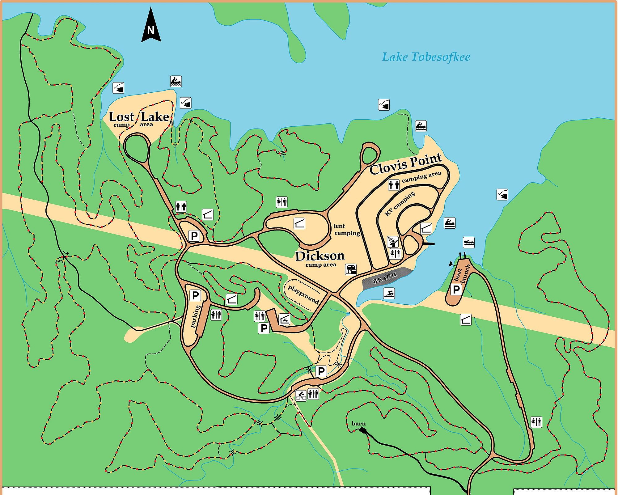
- Arrowhead Park (hike, bike)
- Arrowhead Park (hike, bike)
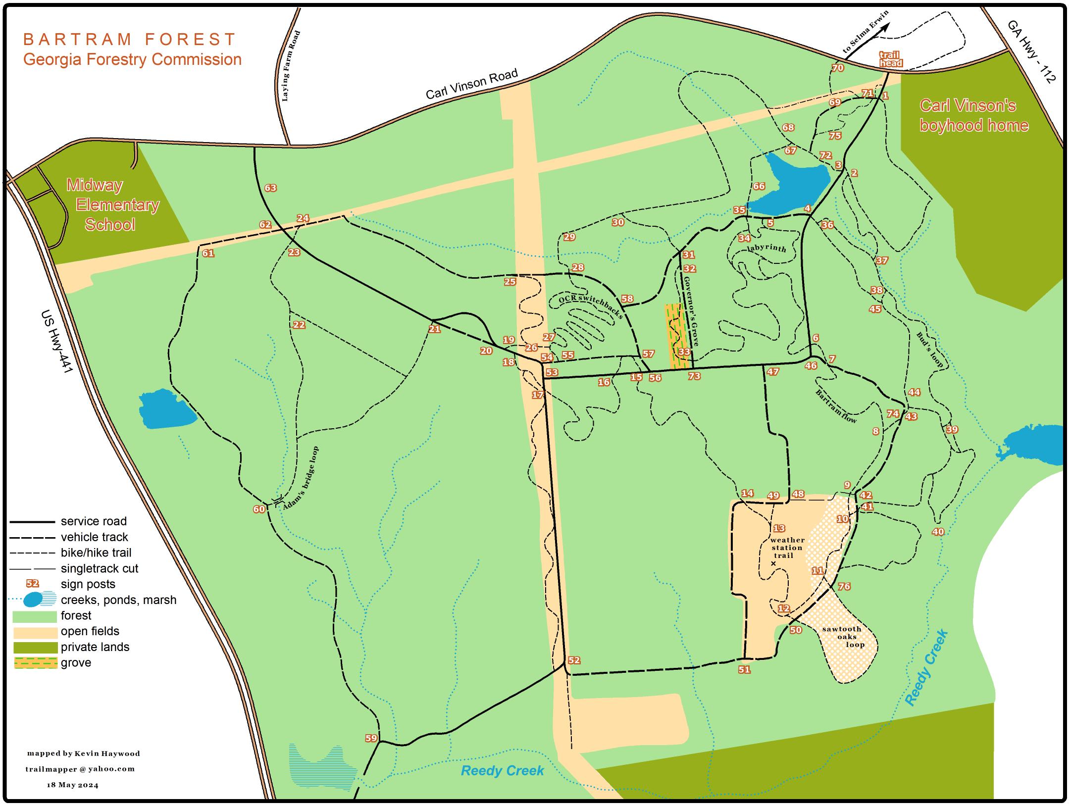
- Bartram Forest Trails (hike, bike)
- Bartram Forest Trails (hike, bike)
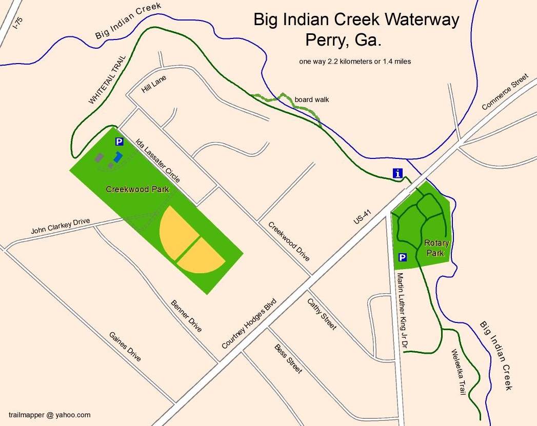
- Big Indian Creek trail (hike, bike)
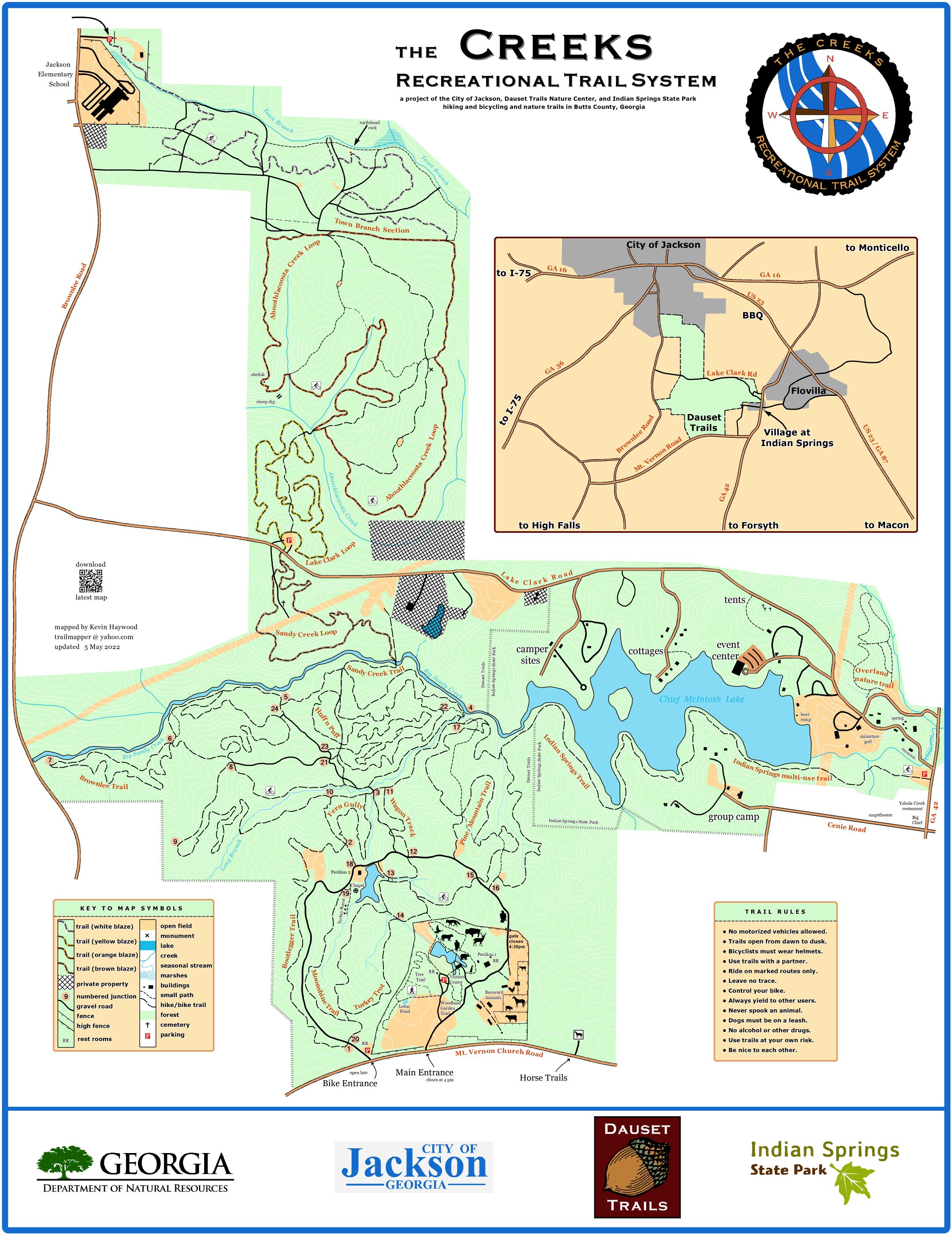
- the Creeks Recreational Trail System (hike, bike)
- Dauset Trails (hike, bike)
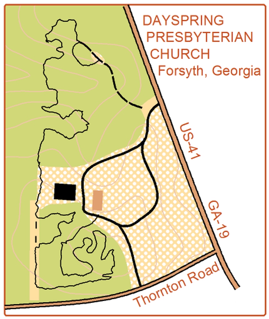
- Dayspring Presbyterian Church trail (hike, bike)
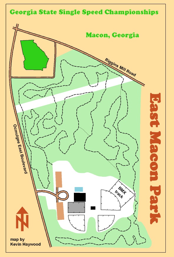
- East Macon Park trail map (defunct)
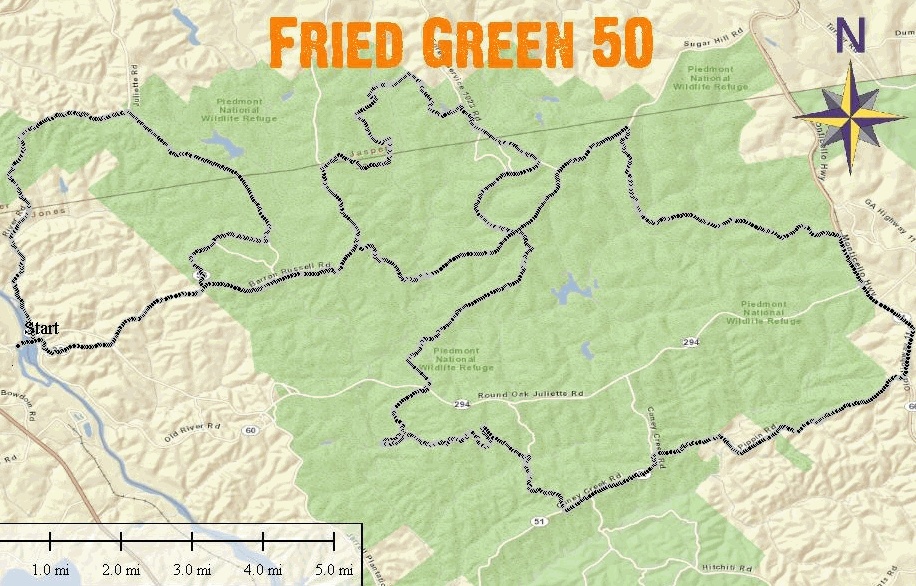
- Fried Green 50 Ride Juliette,GA (bike)
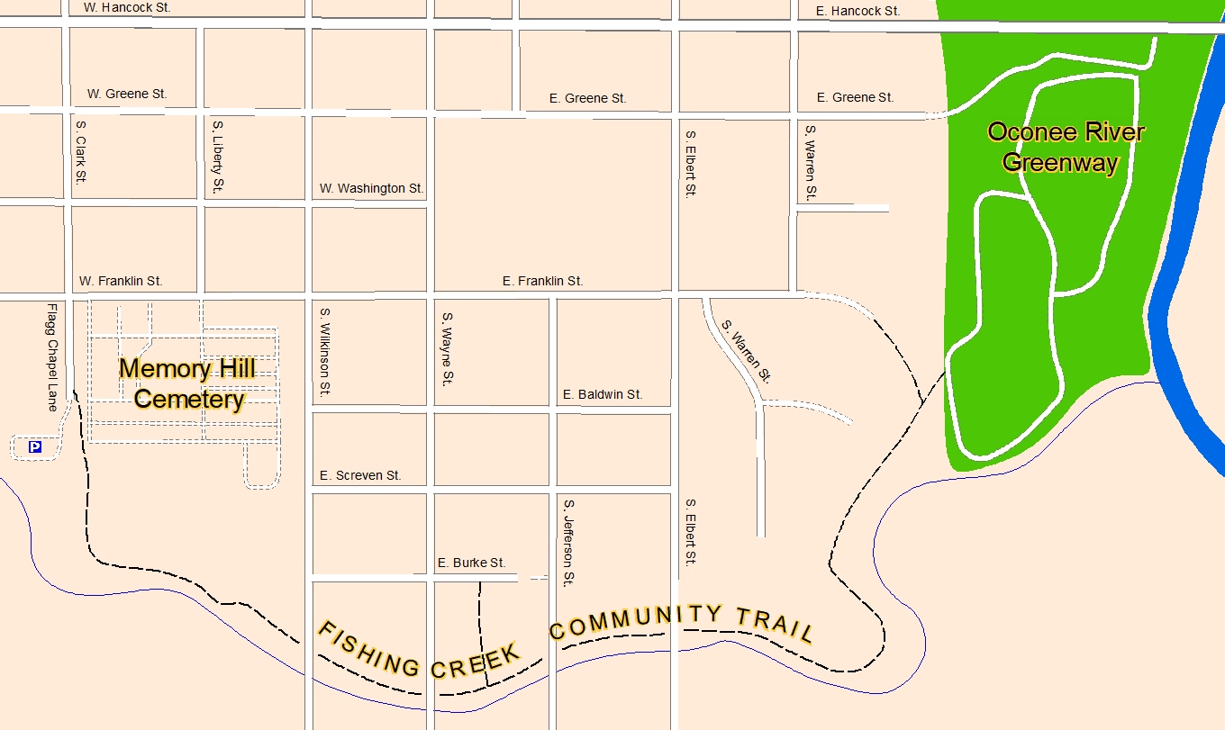
- Fishing Creek Community Trail (hike, bike)
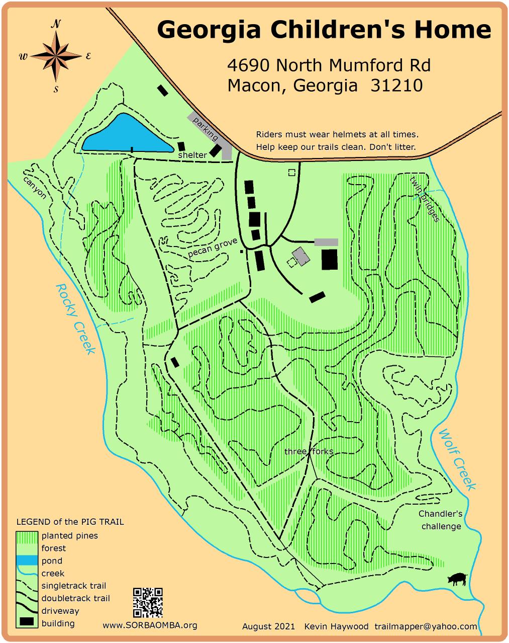
- Georgia Children's Home Pig Trail (hike, bike)
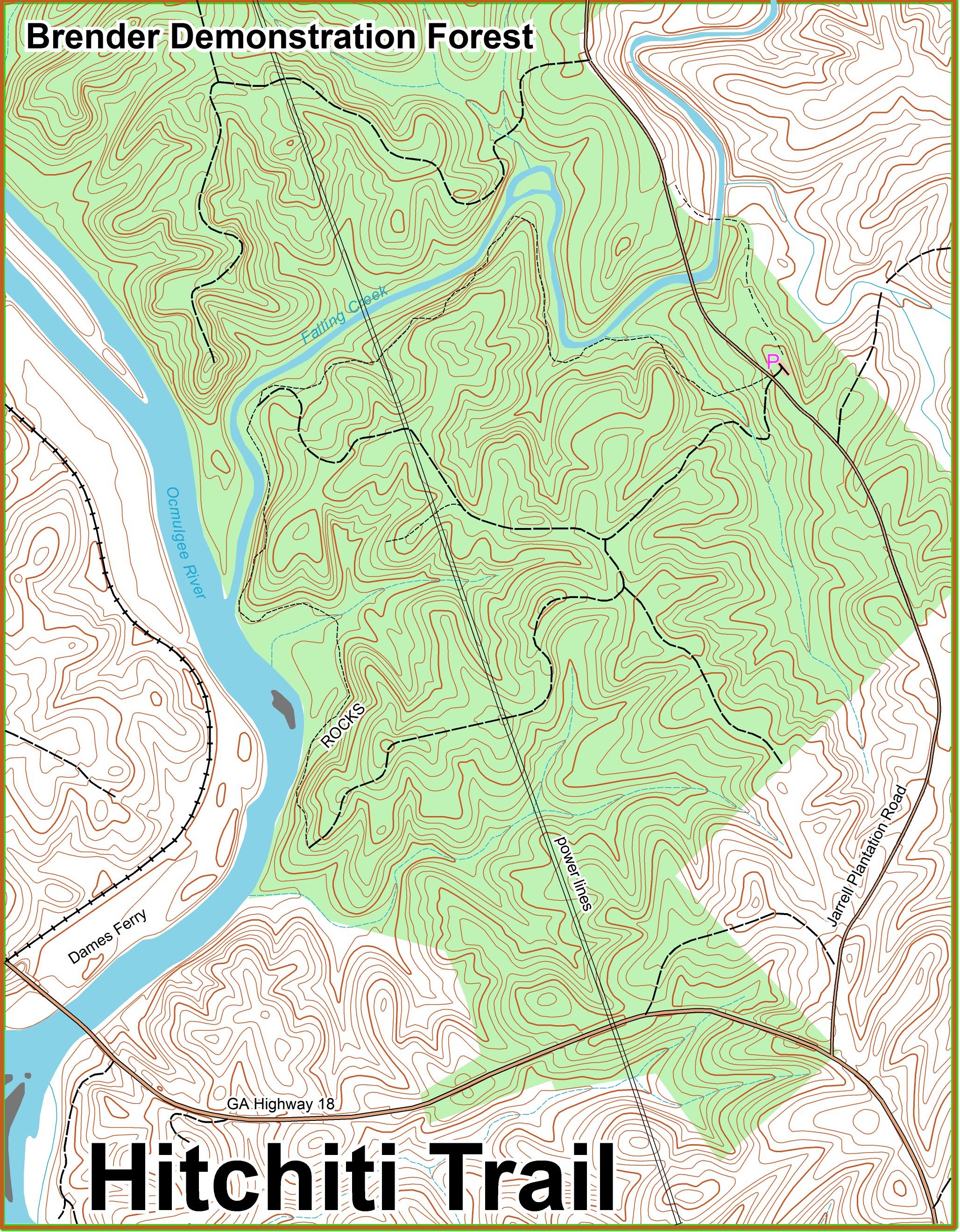
- Hitchiti Trail at Brender Demonstration Forest (hike only)
- High Falls State Park (hike only)
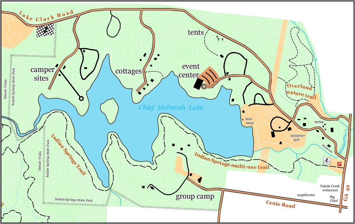
- Indian Springs State Park (hike only)
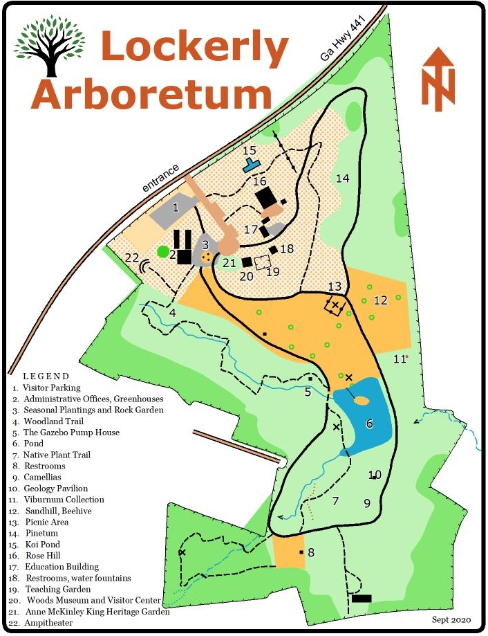
- Lockerly Arboretum (hike only)
- Macon Little Free Libraries
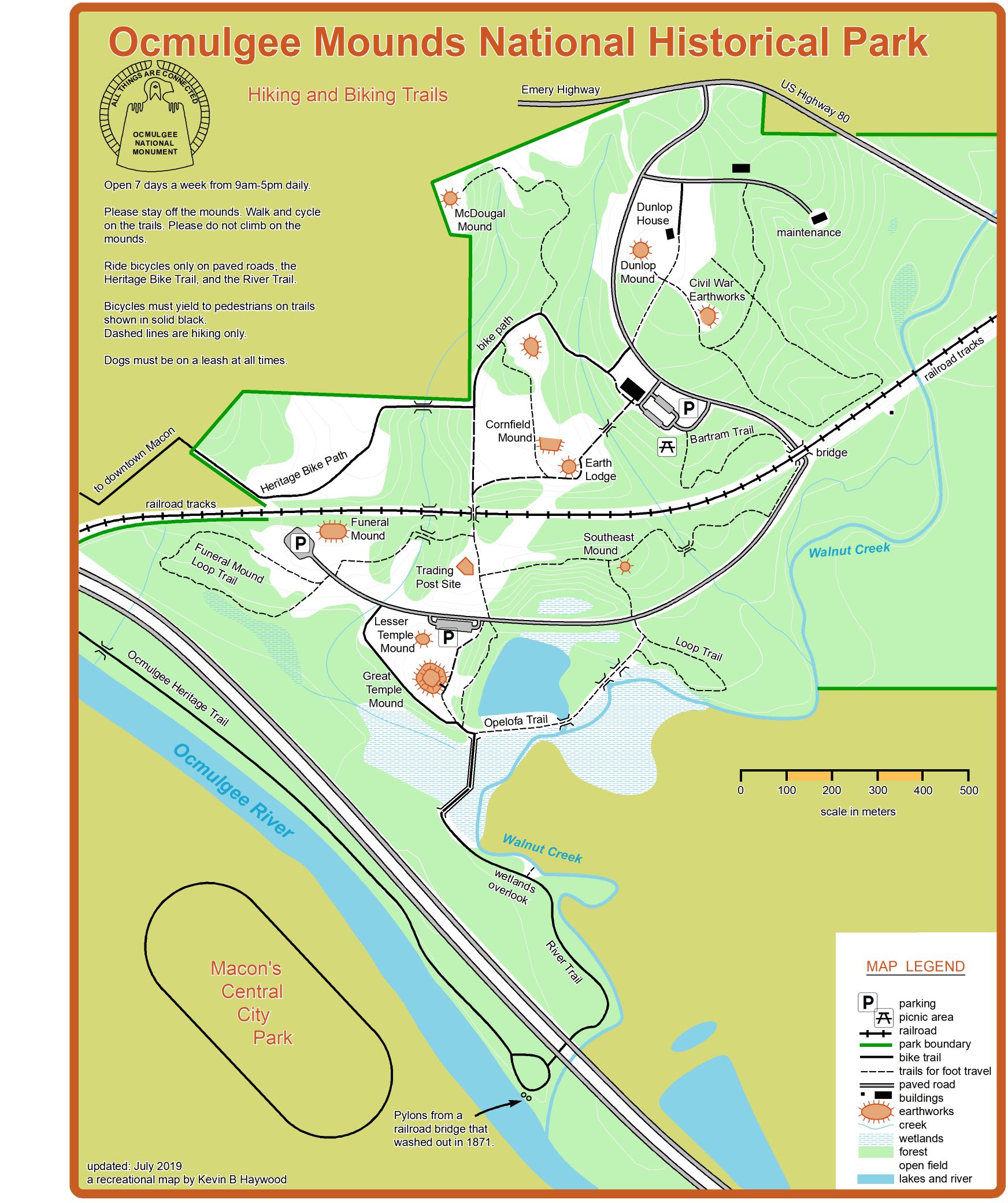
- Ocmulgee National Monument (hike, bike)
- Oconee River Greenway (hike, bike)
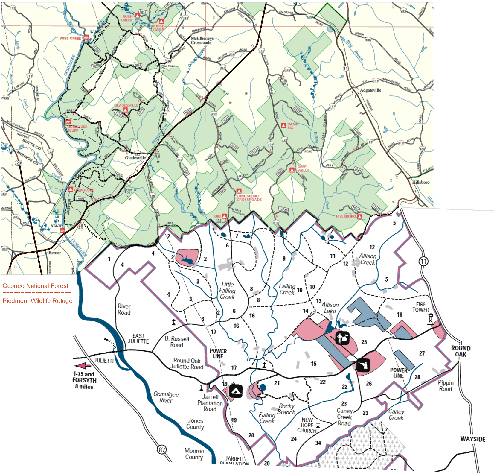
- Piedmont Oconee National Forest (hike, bike)
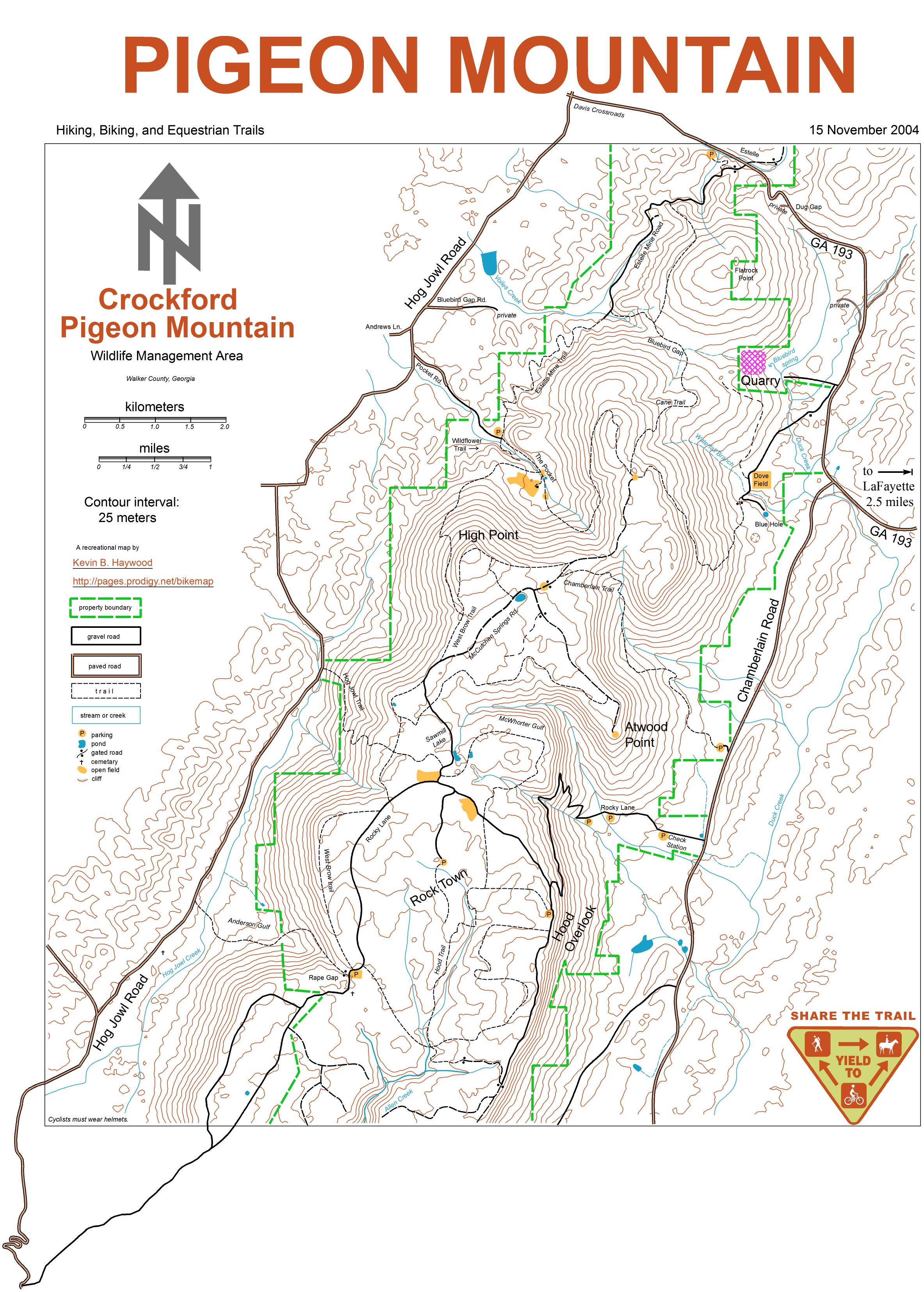
- Pigeon Mountain Crockford WMA (hike, bike)
- Pine Log Wildlife Management Area (hike, bike)
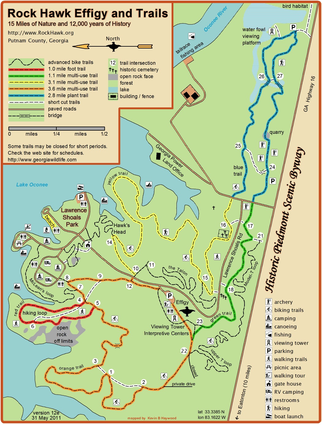
- Rock Hawk Effigy Trails (hike, bike)
- Red Clay Ramble (bike)
- Selma Erwin Nature Preserve (hike, bike)
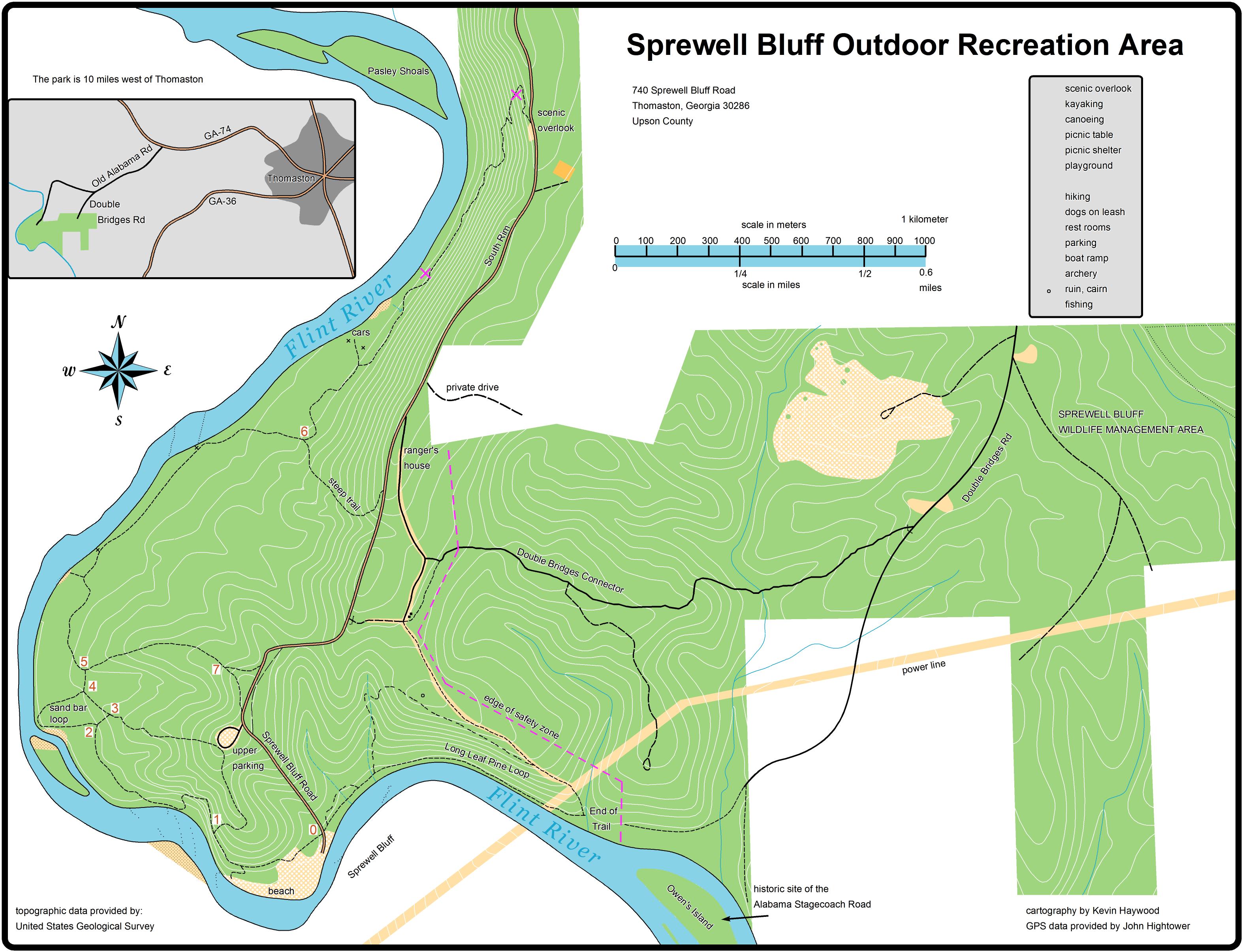
- Sprewell Bluff Trail map (hike only)
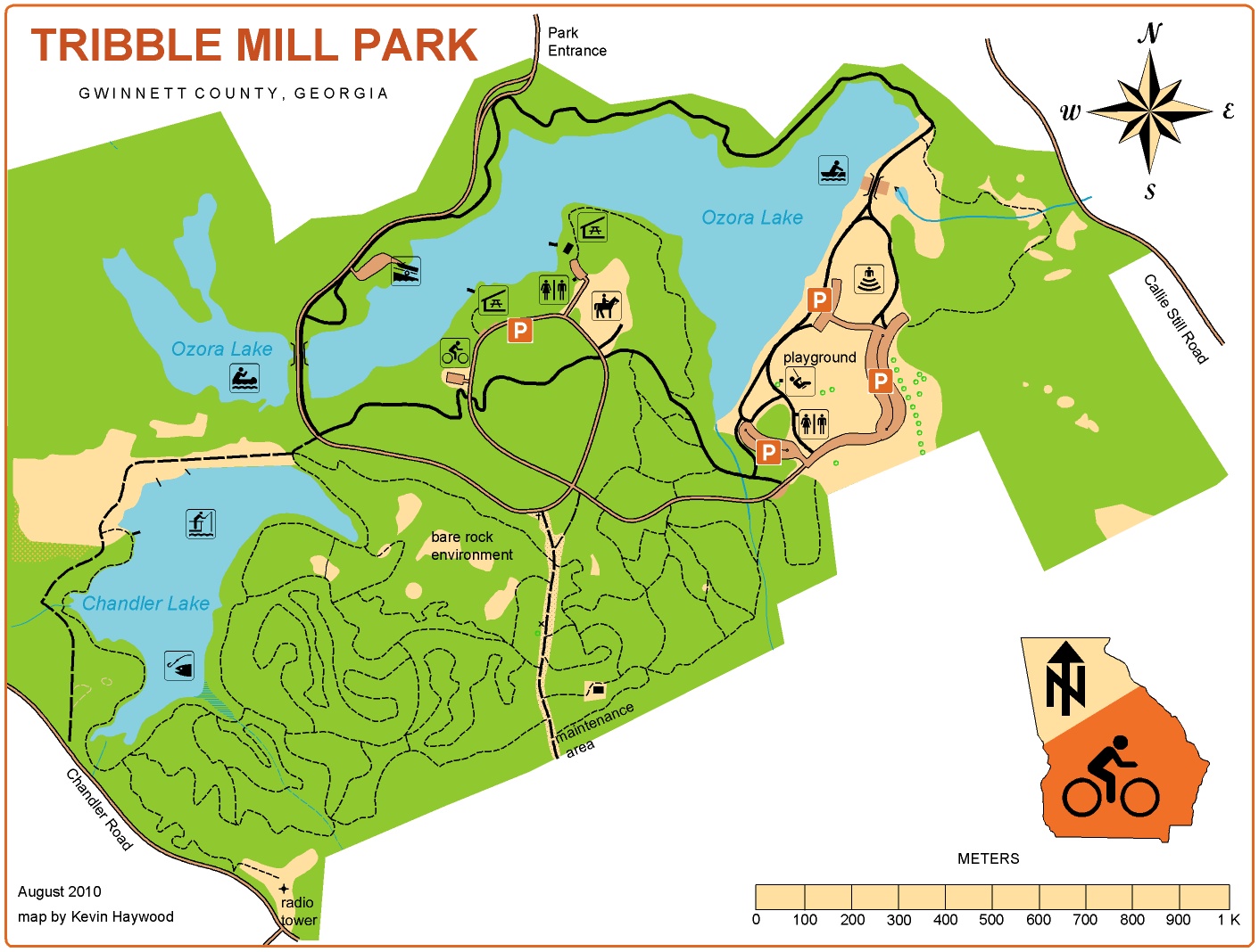
- Tribble Mill Park (hike, bike)
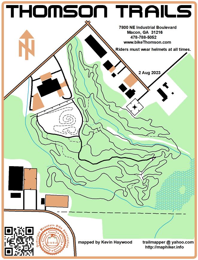
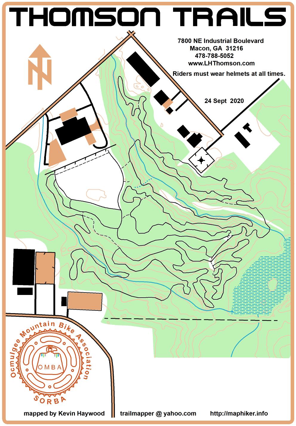
- Thomson Trails (hike, bike)
- Thomson Trails (hike, bike)
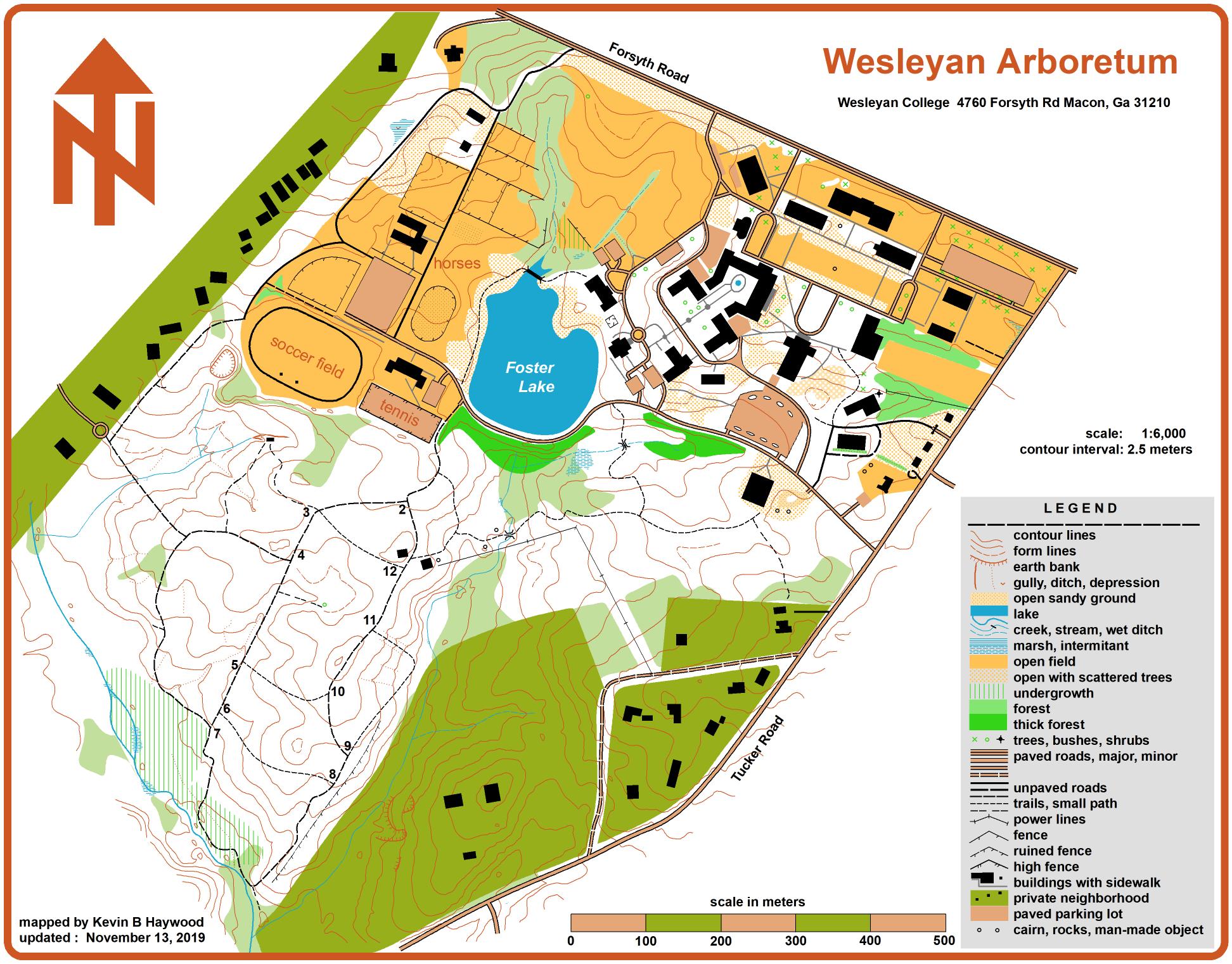
- Wesleyan Arboretum and campus (hike only)
Historic Walking Tours
The Sanborn Fire Insurance maps are now available as a continuous zoomable slippy map. These maps are 100 to 130 years old. You can see older places like parks and streets that have changed names. The maps show old cotton mills, railroad stations, and lumber yards that no longer exist. Some cities have maps from multiple years as far back as 1884.
A slider allows mixing the old maps with new photography to see what was there before the Interstate highways were built. These maps don't show the entire city nor every building. The fire insurance maps main purpose is to show insured buildings.
If you view the page on a tablet or phone, the map can show your location on the hundred-year-old map.
This is great for walking tours of the city as it was 100 years ago.
updated March 2023
Some of the maps on this page were created
using software from programmers in
Ukraine.